Home > Underground storage > GEOLOGICAL 3D MODELLING
Diving into the deep
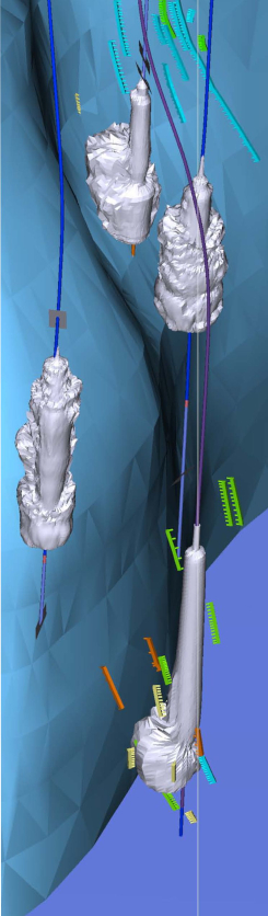
Geological formations are spatial structures and can therefore only be fully interpreted and illustrated in all their complexity in three-dimensional space. With the help of modern 3D modelling software, digital three-dimensional illustrations of salt domes and their cap rock layers are created, which depict the geological underground in detail and have a high prediction accuracy for planning purposes.
Digital geological 3D models are used for the following applications:
- site assessments and analysis of the potential
- resource estimation
- evaluation of safety and pillar distances
- integrity assessment
- drilling and field planning
- geological prognosis, pre-profiles, profile sections, and queries
- basis for geomechanical and dynamic (reservoir) models
- centerpiece of the 3D data management system in brine and storage operations
Through the use of “virtual reality” technology it is possible to enter the digital 3D models and vividly experience the multiple layers and dimensions of a geological structure first hand. In the near future it will even be possible to visualize dynamic processes in a virtual three-dimensional environment.
Additional information: Poster Virtual Reality